Crossing the Cho-La Pass
Everest Base Camp The Lazy(?) Way Day 13
Crossing the Cho-La Pass
The Cho-La Pass should bring us from the Gokyo Valley over the mountains to just below Everest Base Camp. That “should” marks the single biggest variable in our trek so far.
It’s not always possible to cross the Cho-La. And, even where conditions permit, some people do turn back. Nir thinks we can do it, though, to be honest, it’s not my skinny just-turned-twelve-year-old I’m worried about, but me.
My map has ominous things on it like “stay to left side to avoid crevasses” (“LEFT” – what kind of map IS this?), “crampons and ropes recommended” (neither were on my Everest Base Camp gear list) and “danger of rockfalls”.
I bought a length of mountaineering rope in Khumjung, but we have neither crampons nor harnesses.
It’s six hours walk if you’re fast. We’re not. So I’m allowing ten hours.
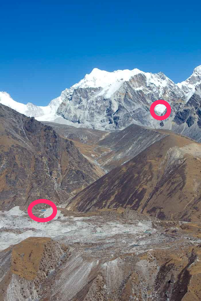
As far as I understand it, we start from Dragnag (circled), walk up the valley, and then head over the top of the glacier (also circled), and down the other side. It looks, to be honest, like quite a long way, and I can’t help noticing that both Nir and I have avoided pointing this out to Zac.
The glacier crossing is only 300 metres, apparently, but we should allow an hour or two. Wha’?!
Slob that I am, I’d have liked to take a rest day, or, rather do the short walk to Dragnag the day after climbing Gokyo Ri, but Nir is insistent that we need to cross the Cho-La pass today, because there are other groups crossing and it will be safer.
He’s anxious, I think, because he’s not a guide but a porter-guide, and he’d really rather be doing this in a group than escorting a woman who’s scared of heights and a twelve year old boy across what the locals all concur is a dangerous pass while carrying far too much stuff.
We engage in some negotiations as to starting time. A Sherpa has told us the danger of rockfalls gets worse after 9am, when the sun starts to melt the ice, so we should be through the pass by 9am. At the rate we walk, that’s going to be a 3am start with head torches.
Someone in the lodge says that the rockfalls don’t look sun-sensitive and that we’d be better off climbing in the light because it would be really easy to break a leg.
Zac says there’s no way on earth he’s getting up at 3am two days in a row, particularly not with the Cho-La to cross, and in that he speaks sense.
We’re both a little bit tired after the crack of dawn start for sunrise on Gokyo Ri, not to mention the landslide drama, so we settle on breakfast at 5am.
I try, yet again, to discreetly lose some of the weight from the pack that Nir will be carrying. He catches me in the act and refuses.
And by the time Zac’s eaten and hydrated, I’ve bundled the sodding sleeping bags back into their rollbags with the broken catches, and we’re good to go, it’s after six.
*sigh*
Normally, I like to walk at our own pace, which involves endless stops for photos, rests, snacks, drinks, furry animals, skating on frozen streams, breaking ice, chucking rocks and climbing stuff, according to the mood of our party.
For, yes, gentle reader, not only am I scared of heights but I’m rising forty, a hopefully reformed smoker and, though my fitness is improving after days of walking up and down steep hills and along these impossibly corrugated valleys, I’m really not that fit.
In this instance, I’ve got Zac to agree to stop only every hundred vertical metres, when Nir, who will for this be much more guide than porter-guide, says he can. Which means I have to do that too.
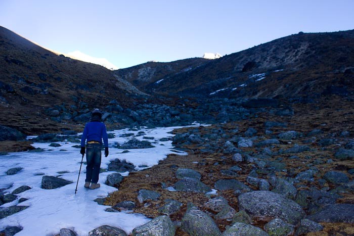
We follow the frozen stream up a stark, black, boulder-strewn valley in the slowly dawning light for what feels like quite an unconscionable time.
Measuring by the rest breaks, though, we’ve ascended 400 vertical metres (1300 feet) before the sun is properly up.
Great, I think! We’re at 5100m (16,730 feet). Only a couple of hundred more and we’re actually at the Cho-La pass.
“Oh, great,” I say, as we emerge from the head of the valley, to a new valley that undulates quite ridiculously up and down towards a field of boulders, work our way down into the sunshine and crack open some nak cheese, oranges and Snickers.
“Cho-La there,” says Nir.
“Wha’?” I say. “There?!”
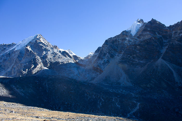
It’s not the glacier at all. It’s the gap next to the glacier, what appears to be a rockfall with a bit of fissured rock exposed and plenty of gigantic boulders poised to squash anyone who’s unlucky to be under them at the time. After our mini-drama with the landslide, I’m a bit scared of rockfalls.
“Yes,” Nir says.
“But…” I say, feebly. “But… Where’s the path?!”
“Up that way,” says Nir, pointing to the right of the rockfall.
I squint at the rockfall. I cannot see ANYTHING by way of a path. Further, I have a sneaking suspicion that once we’ve crossed the black boulder field below the rock fall, we’re going to drop down into something and have to go back up the other side.
“So we go down then up?” I ask Nir, resignedly.
He giggles. “Little bit down,” he says. “Big up.”
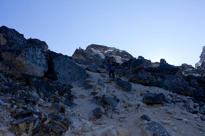
There is, indeed, a little bit of down, and then a hoppety-leapety-scramble over a little field of boulders, which is (whisper it) rather fun.
Well, if you like jumping from boulder to boulder, that is (I do, and so does Zac).
And then we’re at the base of the first rockfall. I look up. I STILL can’t see the bloody path.
A Korean guy and his guide overtake us, and begin to ascend.
“Take break here now,” says Nir. “We need go fast up. Little bit danger.”
Oh great, I think. Another bloody rockfall. And this one’s steep.
“Looks like fun,” says Zac, sardonically.
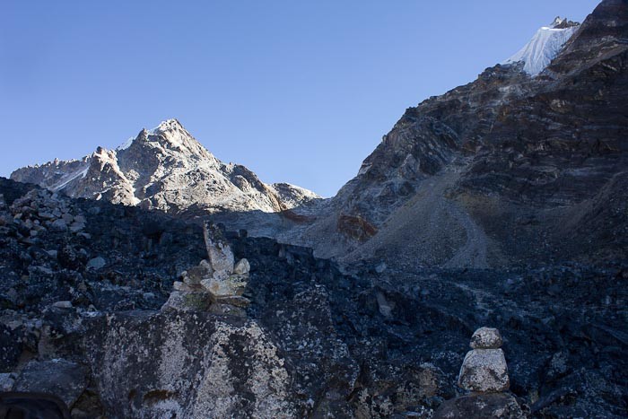
By the time we surmount the first rockfall, my hamstrings feel like lead, I’m breathing more deeply than I could have imagined possible before hitting this altitude, my wusssy 10 kilo pack feels like 30 at sea level, I’m at least 50 vertical metres behind Zac and Nir, and, at the risk of sounding British, I could really do with a nice cup of tea and a sit down.
Zac, ahead of me, has clearly had the same idea.
“No rest now,” says Nir. “Danger.”
We’re scrambling 400 vertical metres up a rockfall at 5000m without a break?! What the fuck does he think we are? Nepali?
“You need to keep moving, Zac,” I say. “We’re in danger of falling rocks so the faster we get up this the better.”
Zac starts to protest.
“GET UP THE FUCKING MOUNTAIN,” I yell caringly. “It’s dangerous!”
Zac heads up the mountain at a pace that almost rivals the Korean’s, who is, I realise, doing some actual climbing on the rock face, proper athletic leg reaches, the whole shebang.
Wow, I think to myself. That looks a bit dangerous unroped.
I am dragging my complaining hamstrings up the steep, gritty path, when I put one foot on a boulder the size of a small car. It wobbles. One of the blessings of having vertigo when it comes to doing things in the mountains, incidentally, is that little things like an enormous boulder threatening to give way and take the entire rockfall and your only child down the valley, not to mention yourself, don’t really worry one, compared to the utter fear of being on something sheer without ropes and harness. All the same, it’s a bit of an odd moment. Then three strapping fit guys come down the path. I look up the mountain. Zac’s nowhere to be seen. Great! I think. I’ll just sit down quietly and let them pass. They need room, right? I totally need to sit down, on that nice, cosy rock right there. Because it’s not like we could walk round each other. Not in the slightest. Not at all. “You going up there?” says one of the guys. “Yes,” I say. I wonder whether he’s asking because he thinks I’m with Zac, or because he thinks I’m solo. “Be careful up there,” he says. “It’s really not nice up there,” says his mate. Oh great.
After they’ve gone, I figure I should stand up again before my son gets to the top and looks down to see me doing the very thing I’ve told him not to do.
But I can’t see the path. There’s a dusty narrow strand that kind of peters out, or a trail of dust and pebbles leading over some rather chunky-looking boulders that form a tempting natural staircase.
I’ll go with the staircase, I figure, and up I head.
I’m just starting to extend a leg to a tricky-looking boulder when I realise a) this is steep b) I’ve made the mistake the Korean guy made earlier and c) now would not be a good time to look down.
It’s actually amazing what one can do without looking down when one is truly, truly scared of heights.
I reverse, slowly, down the boulders, looking at my feet and the rocks but nothing below that, bear right, regain the dusty strand, and plough upwards on burning hamstrings, poking at rocks inefficiently with my rubbish fake Kathmandu hiking pole.
I neither know nor care how far above me my spawn and my guide are.
Prayer flags!!!!! OMG!!!! There are prayer flags!!!! That means… That means… That means… I’m at the top. Or – I manage my own expectations, as I lumber pathetically upwards, puffing like a steam train and feeling approximately 75 – I’m at the top of something. I may well have to go down the other side and up again, but I’m definitely at the top of something.
Anywise.
It should mean I can have a break.
Nir appears between some prayer flags! Zac’s with him. “I take your bag?” he asks. “No,” I say. “It’s only 20 metres, right?”
It takes me a good five minutes to lumber up those few vertical metres. But we’re there! And it’s awe-inspiring, savage in its beauty, one glacier surging down the mountain side, the other cascading in front of us in slumping steps of ice.
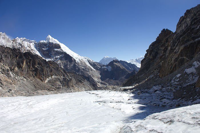
We slump down in the hollow of a rock, looking over a jagged cascade of ice – I’ve read that ice falls are unique to the Himalayas, though that seems unlikely – and unwrap our packed lunches. It’s 10am, and my hardboiled egg, slightly slimy nak cheese, chapatti and orange feel like the best meal I’ve ever tasted. I break the ice on my water bottle and slush it around to stop it freezing entirely.
I can’t help noticing, though, that the wind’s getting up. Cold feels colder at altitude, because your body has to work harder to stay warm, and there’s only about half the oxygen in the air here that there is at sea level. I’m wearing Chinese thermals, two pairs of socks, fur-lined boots, jeans, padded snow pants, a long-sleeved cotton top, a single fleece, a double fleece, a 900 fill down jacket, sunglasses, a thin snood over most of my face, sunglasses, a fleece snood, glove liners, -30 rated fleece gloves and a hat.
Zac, who is obviously part Sherpa, has stripped off his outer layers, and in the sun I unzip a layer. But when I stand, I can feel the wind slicing through to my kidneys. “Chisu tsar,” I say to Nir, still pretty much my only bit of conversational Nepalese. He nods. I’ve forced a spare fleece on him, but he’s still wearing less than us. Although the clothing in which George Mallory may or may not have summited Everest was equivalent to only two modern day fleeces…
We sit in the shelter of the rock, prayer flags fluttering, and I look down over one of those gaping, hellish ice maws I remember from yesterday, while Nir ties sacking to his boots – “Sherpa crampons” they call them. I pull out gauze bandages, which is what we’re using, and scissors. Oh god. I’m going to have to take my gloves off.
After the (maybe) 90 seconds it takes to wrap bandages around our boots, cut them and tie them, my hands are fuchsia. Unwillingly, I unzip my down jacket and work my hands into under my arms. They feel like blocks of ice, and the cold works rapidly into my ribs: my fingers twang and complain as the circulation returns. I wish I was wearing a bra. Or a vest, at least. “How cold IS it?” I ask Nir. “Minus fifteen?” he says. It feels at least twice as cold as that.
We brace ourselves. Zac is serenely unbothered by the prospect of walking across an ice fall. “Zoom zoom,” says Nir.
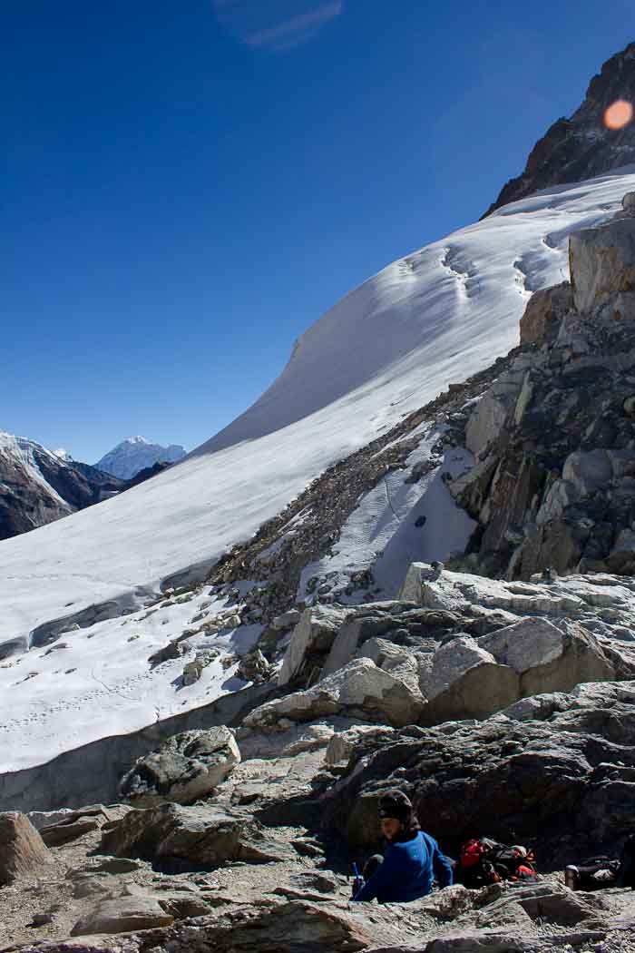
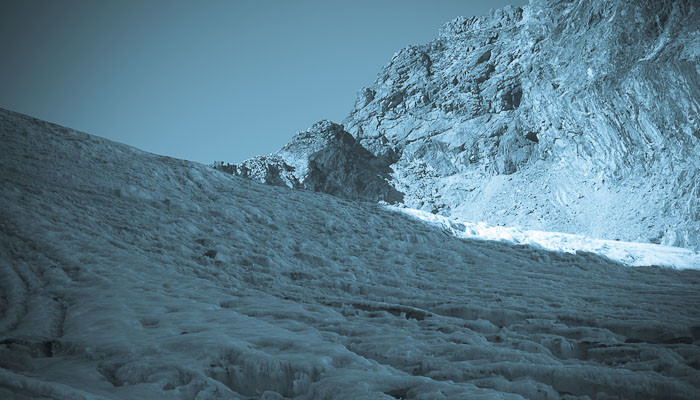
We edge around the ice cave and down onto the glacier proper, the mountains lowering above us. The path is grooved deeply into the ever-moving ice, a cold, glassy blue, fronds of icicles like stalagmites where it’s melted before, transparency marking the history of the sun. The sides are higher, with a crisp fine coating of white snow, so easy to walk on. “No!” says Nir, as Zac veers onto the gripping snow. “Danger!”
Really?! I think. Really? You get crevasses under a coating like this?! It’s so fine I can almost see through it. But not quite. Not quite enough to see whether it’s solid below. We walk slowly, gingerly, inching our way across a surface that’s more slippery than an ice rink, planting one foot, lifting the other, planting again. Zac’s feet skid from under him, and Nir and I grab him. He seems remarkably unbothered.
We come to the place where the ice fall descends in a series of cambered, icicle-ridden steps. “Use rope now?” says Nir. “What do you think?” I ask. Zac’s feet go again. He doesn’t care. I do, though, because there’s an ice slide that could take him right down into the pit below the cliff-face on our right, and once you get started sliding the only thing that’s going to stop you is an ice axe or a big, hard rock. “Wait here,” says Nir.
Thank god the wind has fallen again. We sit on an ice step, holding onto icicles for support – this stuff’s so slippery you could slide just sitting down — and we wait, as Nir inches out of sight, 20+ kilos on his back.
We don’t talk. We just look around, and wait.
A group of three inches past us, and heavy black Himalayan crows circle
Close to an hour passes by the time Nir returns. He loops the rope round himself and round Zac. I loop myself onto the back, and we begin, inching down the icefall, following in his footsteps.
When Zac’s feet fly from under him again, Nir goes with his hands and I pull on the rope. It works. He’s steady.
But it’s painfully slow. It’s a matter of wedging one foot in a gap where the icicles are crisp enough to break and almost grab. The steps are giant stairs, like the sides of the pyramids – there’s a stretch.
There’s enough slack in the rope for me to descend using my bum and feet to shunt along and my hands to steady myself. I really don’t care what I look like, and I’m well insulated so I don’t feel the cold.
The ice fall descends towards a frozen lake, which I think marks the end of the glacier, but in the way of moraine, it’s still buried below us, sliding and roaring.
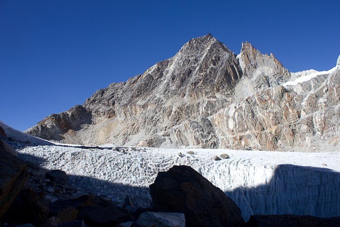
We are almost at the base when there’s a roar and a crack, a louder roar than the creaking and moaning I’ve become used to on glaciers.
“Let’s MOVE!” says Zac. “Run!”
I look up. On the cliff above us there’s a compacted cornice of snow, maybe 10 or 20 metres deep, hundreds of tonnes of the stuff. It looks as dense as concrete, and now there’s a fissure. Was that there before?
“We CAN’T run,” I say. “We need to go slowly, or we’re going to fall.”
I look at Nir. “Alright,” he says. “No danger.”
Then the ice roars again, and cracks, and I can almost feel it move. I swear.
I catch Nir’s eye. He looks terrified. “Quickly,” he says.
The thing about these icefalls is that every few years or so, great chunks of the stuff collapse and millions of tonnes of it just comes down. You’d be unlucky to be there when it happens, but it does happen.
We speed up as best we can, a limping, slow and halting progress: the rope’s short, which doesn’t help.
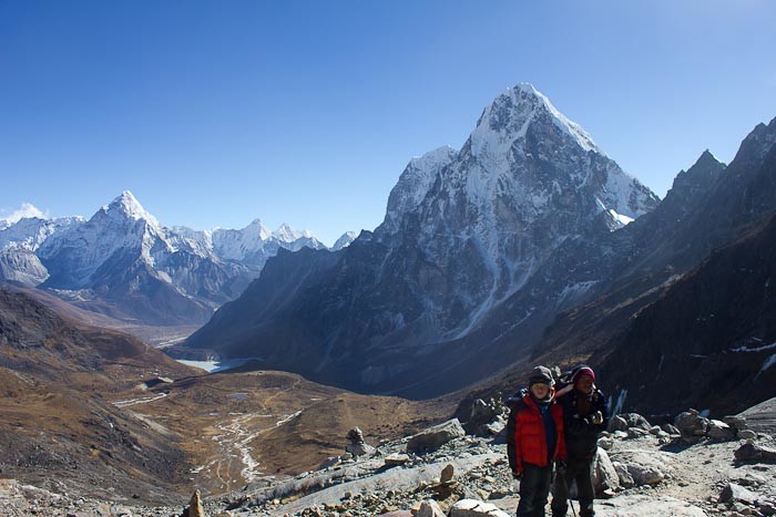
And we’re off the ice. “Whew!” says Zac. “We’re safe now.”
“No we’re not,” I say. “You think that thing’s just going to stop when it hits the bottom of the slope?”
“Little bit danger,” says Nir. “Go quickly.”
We go quickly as we can.
We’re on the rockfall, now, climbing up a catastrophic heap of boulders that line the side of the mountain, dull grey ice below them, holding them up, sliding under the dust.
I can’t believe how hard this ice is, how much it holds up, carrying thousands of tonnes of rubble as if it were nothing.
We scramble up, and around, and along, and down. And then we’re in the sunlight, looking out over the other side, a magical vista of new mountains opening ahead of us, and a path down into the valley.
We sit in the sun. “I am very happy now,” says Nir. “We have success on the Cho-La.”
And he’s right. He’s got one not terribly fit woman and a twelve-year-old boy across the Cho-La in one piece on what is, I think, his first attempt as a porter-guide rather than a porter.
“Well done!” I say. “You’ve really been a guide today.”
Nir claps his hands together in applause, and we give Zac a round of applause. “Well done, Zac!” I say.
We drink our chemical water, pound some sugar, and then look up. Nir points, and we laugh.
We’re sitting below an overhang lined with boulders. Right now, though, I couldn’t even care.
We’re through. And all we need do is scramble down the rockfall on the other side, walk a couple of scant miles down the valley, and head to Dzonghla.
I can see it. We’re through, and it’s actually not been that bad.
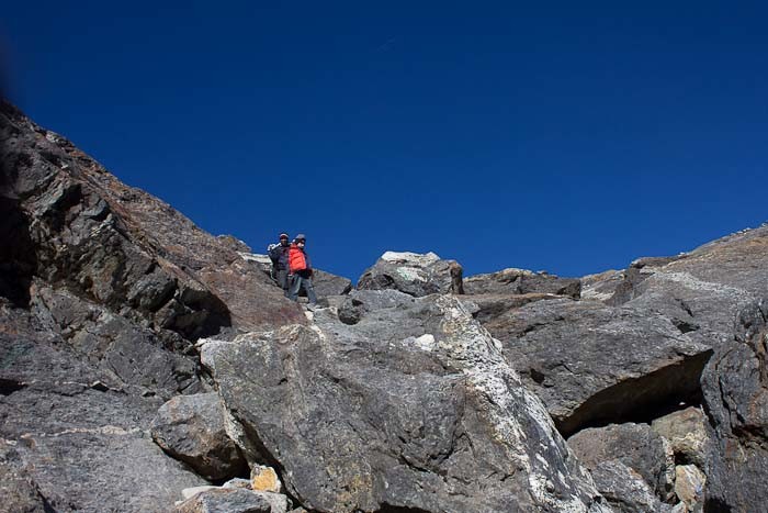
Slowly descending the vast slabs of granite that make up the Dzonghla descent from the Cho-la pass, I realise that I’m not feeling as bad as I thought I would.
In fact, I’m not really feeling bad at all. There’s no pain in my legs. No pain at all. We’re descending, so there’s more oxygen and less cold.
“How does this compare to Mount Kinabalu?” I ask Zac.
It’s not entirely a fair comparison. We’ve been walking every day for a fortnight now, plus or minus, we’re acclimatised to altitude, and Zac is more than two years older than he was then, when we both went up it with zero acclimatisation.
“Oh,” he says. “Mount Kinabalu was harder.”
“Yeah,” I say. At the end of our second day of Mount Kinabalu, having ascended more than a kilometre and descended more than two, my knees were locking and buckling, and I was literally struggling to walk. Here, they feel fine.
And I start to feel a sense of anti-climax.
We’ve done the hard bit now. We’ve beaten the Cho-La. Zac’s got his bragging rights. We have Everest Base Camp, now, which is not so much a view as a vague entity on a moraine, an end point for the journey. And Kala Patthar, a hundred metres or so higher than the Cho-La, but a really easy hill.
“Is it colder in Gorak Shep than here?” I ask Nir.
“Yes,” he says. “Gorak Shep is very cold.”
Bugger, I think. I could really do with a wash now. I’ve been smearing Vaseline on my face like there’s no tomorrow, and I feel grubby.
This rhythm we’ve been in, this blissful rhythm of wake, breakfast, pack, walk, no longer feels so serene.
If you’re thinking of doing the Everest Base Camp trek, I recommend my Everest Base Camp FAQ. You’ll also need travel insurance: read more about the best travel insurance options for Everest Base camp.

What a day!! Congrats on getting through the pass!
Thank you! Lots of people do it, of course, but they tend to be fitter than me and older than Zac.
Good God woman! After a long hiatus of blogging and reading blogs, I return to find you and Z up there!!!! Petrified of heights, mostly falling from them, myself. Kudos to you for doing this and continuing to blog as the same time 😉
Welcome back! I’m actually woefully behind on my life and frantically trying to catch up to where I am now. Interestingly, the trek is really quite do-able with a fear of heights, at least if it’s one of falling down sheer things — most of the time it’s valley walking, rather than cliffs, though some of the suspension bridges provide pause for thought. It’s quite stunningly beautiful, though. SO glad we did it…
What a great description of an adventure hike, Theodora : described fully in technicolour, or is that Theodora-colour?
It’s a shame the pictures weren’t a bit more technicolour, really. But I had to put my camera away for most of it, sadly.
Incredible – such amazing landscapes, and your stories! OMG! move quickly but calmly?? Brava! What a story – thank you for taking us with.
Thank you for joining us, Jessie 🙂
I’m already envisioning that, when I do the Camino de Santiago, I will feel LIKE THIS!
I don’t know. I am really less fit than I can sometimes appear…
Thank you for posting this account- very entertaining and exciting to read! I am doing the same trek in six weeks’ time, and your blog has really whetted my appetite!
Best wishes,
Mike.
Thank you! You will love. And I hope the weather smiles on you…
Oh, wow. I almost dropped my ice cream cone reading this – what a wild experience. Mountaineering is definitely not my thing, but thanks for letting me live this vicariously.
Thank you, Micki. It’s not proper mountaineering, just tough walking but — so glad you enjoyed.
theodora, i knew i liked you before, and i knew you were tough and strong and opinionated which is probably why i backed away from you. clearly intimidating… and then i read this and your new ‘about us’ page and i, well i, i’ve fallen in love. thank you for the honest sharing and the adventures that dear god i pray we won’t have half of on the annapurna (which we will be doing in the safest time we can- sept). thank you theodora. oh, and i love how you screamed at zac caringly… great play on words.
Hopefully you won’t! If you’ve got a guide with you and do the stern safety chat all will go swimmingly…
Fantastic review. The route to Evereest via Gokyo Lakes and over the Cho La Pass is my fabourite by far.
I’m glad you think so, Paul. I wish we’d done the Three Passes Trek, in fact, but, although Nir thought we could do it, it had sounded too hard to do with a child…
Please, what kind of camera are you using? Your photos are magnificent!
Also, I should add that we are about to embark on this trek – departing March 29 from Los Angeles – will (hopefully) complete the Three-Pass Trek counterclockwise from Namche. Super excited!
Ooh! The Three Passes! I’m jealous!
Theodora, I’m in the process of writing a book about our Three Passes Trek. . .I hope you won’t mind if I cite portions of your story about Cho-La since I read your blog before I left and I based a lot of my expectations from your account of the pass.
I have a question. . . .where did NIR disappear to for an hour? Was he looking for the route? And when you guys crossed the glacier (tied into the rope), was the gap on your right? Because we crossed from Dzongla, and the gap was on OUR right, which makes me believe it should have been on YOUR left?
I will email the chapter I wrote for you to read if you would like. . .
~Elaine
Hi Elaine,
You’re more than welcome to quote short portions, that’s fine: and do send me a link to the book once it’s done. In answer to the specific questions
Nir was taking the bags down when he disappeared, because he was a porter guide. He knew the route but didn’t feel he could carry the bags and get Zac down safely at the same time. As regards the gap, I can’t reliably tell my left from my right: the huge snow-slide was on our right, if that helps… LMK if you want me to send some pictures that might help clarify this…
Theodora
Thank you! I’m using a Canon Rebel T2i, or EOS 550D — it’s quite old, but it’s a good camera. I also edit lightly using Adobe Lightroom: crop and adjust colours and exposure if required.
Hi, I am planning to do the Three Passes Trek with my friend from Australia next week. I really appreciate your blog, gives a great insight into what to expect.
We are not planning (at this stage) to take a guide (but your blog is making me think we might need one for Cho La. Aaron is a guide/outdoorsman but I however run the administration of an orphanage in India (ie I sit at a desk everyday). Not sure how we are going to go, but its sure going to be an adventure.
Thanks again for putting this up on the net, there is not heaps of info out there so its really appreciated.
There are freelance guides and porters that you can pick up at the guesthouses before the Cho-La, who’ll take you over the pass. People DO do it without guides, particularly if there are a lot of folk crossing, but it’s difficult because it’s not obvious from the valley which bit of ice you’re supposed to head to (it’s the less obvious of the two). I’d be inclined to hire a guide for the day to be on the safe side: all the guesthouses should be able to help you.
Awesome, that’s really great to know. Thanks for the insight -its really appreciated. 🙂
I have had my original EBC trek postponed for one year just 12 weeks before I was to fly out to Kathmandu. Having been so excited the last minute postponement was heartbreaking. Not wanting to wait another year, I asked a few company’s and was offered Cho-la Pass Trek. I was initially nervous about my capabilities but your blog has inspired me, not only as a single traveler, but to have faith in the semi fit (not completely unfit) condition. Your insight and lovely photo’s have made all the difference. As an expat in Holland any last minute advice for conditioning?
Hey Davi!
The great news is that going up the Gokyo valley is fairly conditioning in itself. Day 2 of the trek is fairly brutal – AKA steep – for those of us who are only semi-fit, especially when people LITERALLY run past you. But the Gokyo valley has pretty lovely easy ascents (well, some hairy rock staircases). I only had an OMG this is horrid moment on Day 2, where there’s a long and solidly uphill stretch, and the first day of the Gokyo valley.
Conditioning – go up and down a load of stairs, loads of times. Will tone up the knee/thigh/calf muscle set and reduce the pain of the first two days (my hamstrings complained a LOT on day 2). We didn’t bother with conditioning, but ascending and descending stairs (carrying weight if you’ll be carrying your own gear) is the perfect practice, and easy to do in the flatlands of Holland.
I’ve got a book from a reader – Footsteps of Gopal – about the Three Passes (she’s in her 50s, from memory) that I need to collect from the post office. Haven’t reviewed yet, as I haven’t been to the post office yet, but you might also want to read that for further inspiration/information. ENJOY! And… let me know how it goes.
Theodora
Wow… Wat a nice recap… I did the journey using 14 hrs… Left at 4am reach at 6pm… In total denial on my altitude sickness… Lolz… No mood for photos at all… Thanks for waking my memory… N ya.. I thank god that i live to brag abt it… Quite a accomplishment for a short-legged person like me… Haha…
My boy is still very proud of managing it. He was only 12, god bless him.
Excellent description! I admire your stamina and zeal. Really….
I am planning for the same route in 2015. I know that crossing Cho La from the other side is comparatively easier since its less steep if ascend from Dzongla side (after visiting EBC, taking Gokyo loop route to come back to Lukla), but my aim to do it completely in counter-clockwise direction. Obviously ChoLa is steeper at Thagnak side.
I do not want to engage guides otherwise since EBC is doable just with a porter. But I have experience of crossing glaciers and this is prompting me to take a guide for sure at least in glacier region. So either I need to take a guide all along starting from Lukla, or I can hire one near (before) ChoLa pass, if available.
Therefore could you please confirm if guides will be available from Thagnak or Dzongla lodges who can help to cross ChoLa? And do you have any contact nos. of any lodge/guest house in that area, or may be contact no. of a porter or porter-cum-guide? That will be a great help. Thank you.
Hiya, Yes, I’d imagine there will be guides available at the lodges on the other side, and people do do it in two different directions. There aren’t any phone lines up that high, and I don’t think there’s phone reception for mobile, either, so ringing ahead would be almost impossible. Availability of guides depends on when you are doing it — if there’s high demand for guides, you might need to wait a day or join up with another group doing it. If you already have a porter who knows the Cho-La, you might be fine just paying him something extra to act as a porter-guide for that day. We used Nir as our porter-guide, but I think he’s now progressed to the junior guide stage of his career – you could ask Narayan at Trekaroundnepal.com if he can connect you to a porter/porter-guide who’s skilled enough to guide the Cho-La in reverse, and what the fee would be for porter-guiding your planned route (that way you also get support in terms of changing tickets out of Lukla if the flights back up). Doing it in reverse you might well want to consider crampons – no one seems to use them, but they’d come in extremely handy. Theodora
A few more questions:
1) Do you have Nir’s contact number? If yes, can you share?
2) When you say “Cho-La in reverse”, do you mean crossing it after visiting EBC and while returning to Lukla (so it’s counter clock-wise) OR crossing it first and then visit EBC (clock-wise, Gokyo side first, then EBC)?
3) My previous post has a typo – I am planning to visit EBC via Gokyo side (so it’s clock-wise only), but I mentioned “counter-clock-wise”.
4) Most of the people visiting EBC via Gokyo do it clock-wise only I guess, even though Cho La pass ascend is steeper at this side (from Thaknag side). I also want to do the same, and not the other route around (first EBC, then Cho La, then Gokyo). Reason is that after Kalapatthar & EBC visit, body & mind will obviously want to return ASAP, so I doubt how many team members will try to cross Cho La after visiting EBC.
5) Exactly when have you done this trek – Nov. / May / Oct.?
No, I don’t have Nir’s contact number – but Narayan at trekaroundnepal.com can hook you up with him, I’m sure. By in reverse, yes, that’s exactly what I mean – crossing into Gokyo from the EBC direction – but we did it in the direction that you did it in, which is clockwise. You’re right that it’s the best way to do it – if you wanted to extend you could add in another pass, for an even more dramatic hike. I firmly believe that doing EBC on the in-out route could be actively disappointing in May/October – at peak – because even in December there was a degree of traffic on the trail, and I can imagine it being quite unpleasant at peak (you have to stand back to get out of the way of mule and yak trains). We did the trek setting out in late November, and reaching EBC on 12 December, but we took more “rest” and acclimatisation days than some do, as you’ll see if you plough through the whole series of posts. I’m not sure the Cho-La would have been passable if we’d done it much later, because it started to snow when we were heading down – it can be unpredictable. The Cho-La, FYI, is harder than EBC, and Gokyo Ri is higher than Kala Patthar (we also got a LONG way up Machhermo Ri by accident, because someone told us it was 5,000m, which it isn’t).
Thanks for your reply. Unfortunately we cannot afford many leaves from office. So getting a 3 week leave is a job in itself 😉 I would love to cross Renjo La, visit Lungden village or reach till top of Chukhung Ri, but need a lot of time for that… Currently planning for this trip starting from April end.. Shall read through your travelogue thoroughly 🙂
I’d almost suggest that you do that instead of Everest Base Camp. You don’t get the bragging rights, but you will get an interesting story to tell….
I understand what you meant, Theodora! Hope to be able to embark on those long journeys some time in future… I know EBC is cliche and the calmness of those quiet villages attracts me more. But shall be back in Nepal after completing this one.
I totally get that, Apoo. EBC IS a bucket-list item, and it’s worth doing for that alone.