Alpine Paradise – Everest Base Camp Day 1
Everest Base Camp The Lazy Way – Day 1
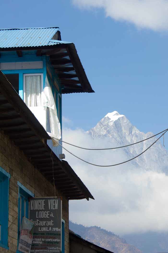
After the terrifying flight into Lukla, the town itself is surprisingly charming: brightly painted, wood-frame houses with long, alpine eaves overhang narrow cobbled streets, where the deep tones of brass bells announce oncoming yakalo trains ferrying sacks of rice or camping gear up into the hills, and stony, stepped paths lead down into the valley through scrub, autumn flowers and ancient dry-stone terracing.
Nepali people in general remind me a lot of Laos and, to a lesser degree, Indonesians: an incredible cultural and linguistic diversity united only by a general warmth, kindness, friendliness and curiosity.
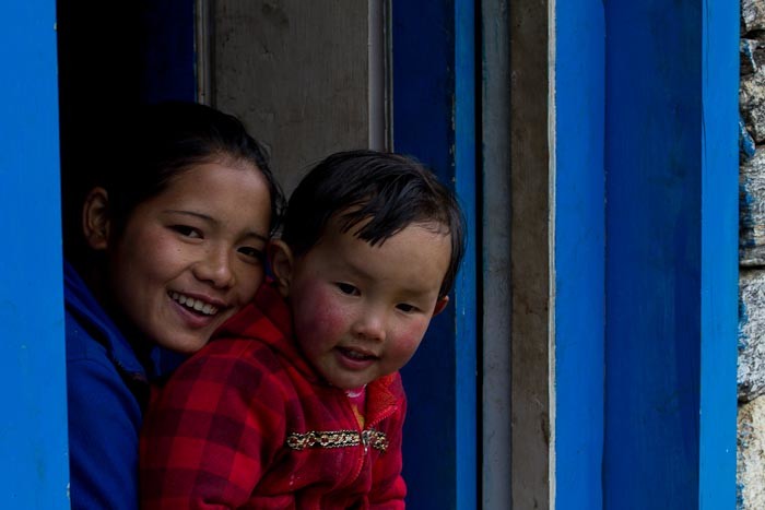
I warm, instantly, to the Sherpas, the chubby, apple-cheeked toddlers crying “Namaste”, the pretty, sunny mothers who care for them, the dignified older ladies and gentlemen still pounding these hills as they always have.
The sky’s a brilliant blue, the sun so warm we strip our jackets off, and, all in all, despite a sleepless night, life’s good.
When it comes to reaching Everest Base Camp, we’re not really tied into a schedule. Our flights out of Lukla are changeable. Nir, our porter-guide, is geared to work either more or fewer days than the 20 planned.
And I’d like the trek to be both safe and, with the exception of a few days that just ARE brutal, fundamentally fun.
I’m carrying a few kilos of layers, food, fluids, emergency medical supplies and general useful crap in Zac’s pack, which we’re using as a day pack. Zac’s carrying nothing but his trekking pole, his pockets stuffed with camera, gloves and head torch.
Poor Nir is laden down with 18 kilos of our crap plus his own rather less extensive needs, although by non-tourist porter standards 25 kilos is a bagatelle.
I watch, gobsmacked, as men shorter and not much heavier than my 12 year old, 32 kilo son, haul loads of 50 kilos or more down into the valleys and up the other side.
Amazingly, even in late November, the sun is so bright and warm here, a mere 2840 metres above sea level, that we remove our fleeces and walk in T-shirt and jeans.
We have a loose plan in place to head to Namche Bazaar, the trading town that’s the focal point of the Everest region, then up the Gokyo valley to see the glaciers, glacier lakes and mountain views and across the Cho-La pass (weather and fitness permitting). Then we’ll join the Everest Base Camp trail and head up to base camp (a fundamentally unrewarding strip of ice) and Kala Patthar (the peak that’s actually the point of that particular trek.
The only real constraint on where we stop and when is altitude – once above 2900m, you are not supposed to sleep more than 300 metres higher than you did the night before, ideally having climbed higher than that during the day. You should also sleep two nights at the same level, climbing higher on the intervening day, for every 1000 vertical metres.
And, at least on its lower elevations, the trail is absolutely littered with Sherpa farmhouses converted, at last notionally, into trekking lodges.
So, despite our 25 minute flight managing to be over 3 hours late, there’s really no constraints on us as we amble down the valley in the general direction of Chheplung, which Nir has selected as an appropriate spot for lunch.
Which is good. Because I have no small concerns about our fitness.
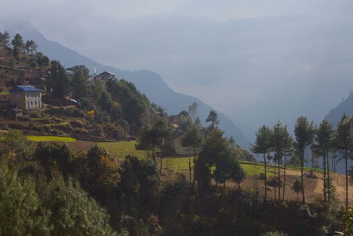
And yet, as we descend, I’m not really thinking about my fitness. I’m just gobsmacked by how very, very beautiful it is.
Alpine meadows with tall firs hover over the valley as if in space. An absolutely classically beautiful peak, Kusum Khangkaru, overshadows the valley, crowned in a perfect triangle of snow, as perfectly mountainous as a child’s drawing.
Scarlet monasteries, or gompa, cling to the cliffs – and I wonder, idly, how it is that monks of every religion on this earth seek out the mountain fastnesses to do their thing – prayer flags fluttering around them, bright white chorten (stoupas) gilded, eyes gleaming.
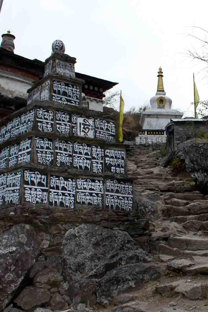
And the religion, the lovely animist-Buddhist fusion that Sherpa people practice, is everywhere. Mani stones, slabs carved or painted with chants and prayers, line the pathways, and climb up the rocks. Prayer flags flutter at every peak or corner, like cairns.
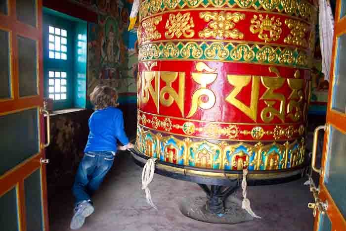
And prayer wheels! So many prayer wheels! Great, huge prayer wheels that hold a million prayers or more, brightly coloured, housed in their own temples, so big Zac needs to take a run to spin them clockwisse until the bell rings, the ritual three times.
Smaller colonnades of prayer wheels, copper or brass, that one runs a hand along in passing, and the other way when coming up. Little monasteries with bright golden daisies sprouting in their gardens.
Zac bounds ahead of me, spinning every prayer wheel he passes. Below us, the Dudh Koshi appears, a surreal shade of turquoise, tumbling white over fallen rocks.
The sky clouds a little, and we don our fleeces, and continue to walk, pulling into the cliff side of the trail to let the mule and yakalo trains pass, cheerily namaste-ing everyone we meet coming up.
In addition to my dubious fitness I am, despite my best efforts, still scared of heights (yeah, I know! The perfect combination for Himalayan trekking, right?! At least I am, as far as I know, relatively OK with altitude).
After a couple of truly dubious suspension bridges in Northern Laos (one was missing multiple slats, the other hung 50 metres or so above the water without even the courtesy of a hand rail), I am really not looking forward to the bridges along the trail.
The first few we cross are fine: sturdy, solid affairs with decent hand rails, most at either maybe-a-broken-ankle or, at worst, quite-possibly-survivable height above the rivers.
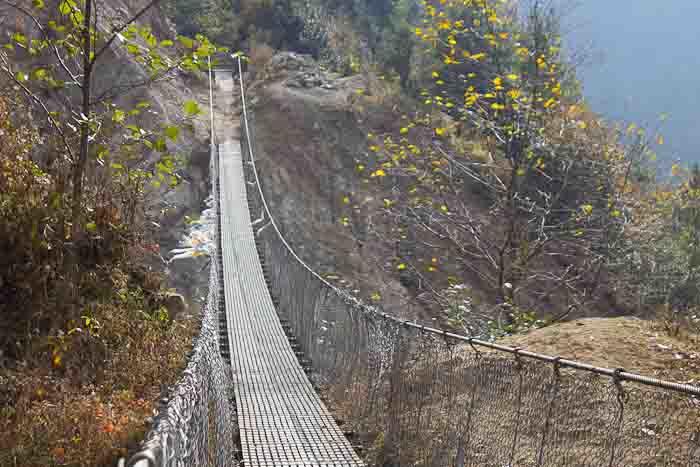
The one before Nurning, however, gives me pause. A proper suspension bridge, it stretches at this-will-definitely-kill-you height perhaps 50 metres across a canyon whose sides have been savaged by a landslide.
It’s good and solid, a floor of steel grid, a sturdy handrail, and wire mesh between the grid and the handrail, but…
It’s still a suspension bridge.
“Not look down!” says Nir, and giggles. “Look other side!”
He takes Zac across. Which is one less thing to worry about.
“Don’t look down!” Zac yells.
I don’t know why people always feel the need to remind me not to look down. Of course I’m not going to look down! I’m scared of heights!
I psyche myself up. I need to start crossing before I hit a mule train, a porter train or — please god, no! — a yakalo train that will set the bridge to jangling.
I figure it’s less than 100 paces to the other side. I stare fixedly ahead, step onto the bridge, grab the hand rail and teeter, geisha style, across, counting each agonisingly slow pace out loud.
78…79… 80…
I’m over! Nir and a passing porter, who has patiently waited while this giant and inexplicably terrified Westerner mutters her way across a perfectly standard bridge, burst out laughing.
I too can see the funny side.
“Well done, Mum,” says Zac, supportively.
And the next suspension bridge I cross holds no particular fears.
As we amble into Phakding, where we are, it is clear, now going to spend the night (I’d thought we might carry on for a village or two more, but Zac has other ideas), I am beginning to realise that my standard issue Nepali map might be playing fast and loose with its contour lines.
“What do you MEAN?!” says Zac, channelling the translator of our playing cards. “The feel and quality of that map is clearly larruping.”
What neither of us had realised was that Himalayan gorge walking involves endless ascents and descents, some of them steep, to follow the curves of the valley. We are both more used to the type of gorge walking that stays, essentially, at river level, or close to it.
This means that to one’s baseline count of vertical metres from starting point to finishing point, one will typically add hundreds, if not a thousand or so, more in a standard walking day.
Tomorrow’s ascent of (officially) 800-odd vertical metres, which had seemed perfectly doable (nothing on Kinabalu!), now seems, well, rather ominous.
While we’re not in any pain, we’re definitely feeling the walk in our calves – the altitude is only evident to me in a slightly increased heart rate, and then only when I think about it, and Zac can’t feel it at all – and, umm, tomorrow, I reckon, is going to hurt.
We like our little lodge in Phakding. 500 rupees (provided we eat in the lodge) buys us a little chalet amid the pines, with two clean beds, four clean duvets to add to our sleeping bags, a bathroom of our own, all-night electric light, and water theoretically defrosted by solar heating.
Our 500 rupees a night (plus food), is, I learn, putting our hosts’ two daughters through university in the States.
“How old’s your daughter?” he asks.
“He’s actually a boy,” I say. “He just has long hair…”
It’s an explanation that I’ll be making all the way up the mountain…
With sunset, of course, the temperature drops.
And in the manner of Chinese teahouses, one then retreats to the brazier in the main eating space, before returning to a room so bracing that one’s breath makes clouds of steam and huddling rapidly under the covers.
Camping in northern China in November, I remark to Zac, makes an EXCELLENT preparation for high-altitude trekking in Nepal.
I am acutely aware that neither of us will be doing much washing en route to Everest: above about 3800m it’s bucket washing only, even in the really expensive lodges. In fact, Zac intends not to wash at all.
But, as this will be the lowest we’ll be for three weeks, and this tepid water comes entirely free of charge, I push the personal hygiene boat out: I wash my face, AND my underarms, AND change out of ALL my clothes and into pyjamas!
GO ME!
“Well,” I say to Zac, as we snuggle up with book (me) and Kobo (him). “At least with all that dhal bhat we’ve been eating we’ve got plenty to keep us warm at night…”
“Yeah,” he says. “I think I just dhal bhated.”
It begins…
You can read the next post in this series on doing Everest Base Camp with kids HERE.
If you’re thinking of doing the Everest Base Camp trek, I recommend my Everest Base Camp FAQs.

Starting the trek with a dhal bhat! Not sure it gets much better than that, but I look forward to following your trek. Sounds pretty incredible!
Apparently tonight’s dhal bhat is going to be one of the best on the entire trail… I’ll keep ya posted.
I loved hiking in Nepal but yes, those valleys do play havoc with the daily elevation count. It is stunning though isn’t it?
Unbelievably so: absolutely jaw-dropping at times. A whole bunch of posts coming up very soon…
I’m enjoying this adventure already. One more place to follow in your tracks. Enjoy!
Take it slowly, and allow yourself lots of time, and it will be one of the most amazing experiences EVER.
Love the Alpines, our dream place to be. Lucky you and Zac. The pictures are magnificent.
Thank you.
I had never really thought of you as the ‘Innocent at Large’ …keep trekking and reporting back
We will do! Just found internet, so can now report back…
It is SO beautiful, and I’m so glad you’re both enjoying it.
Yes! And we still are, even now. Both of us finding it less painful, more interesting and more beautiful than anticipated. Although you can quote me on the pain after we cross the Cho-La Pass three days from now.
Loving following you on your journey!
Thank you! Lots more posts coming soon.
Great first post for the journey Theodora. Looking forward to the next installment!
Coming up very soon if this satellite internet continues to behave!
You are amazing! Seriously a role model on how to live a freaking awesome life. I just found your site through the ‘Wireless Ideology” interview and I am *hooked* …I’ve literally been reading back stories for the last two days… if you put these into a Kindle book or similar style I would definitely buy it, just to be able to read your adventures on the go! 🙂 Good luck with the trekking, and thanks for sharing your life with us!
Leah
Thank you, Leah! I do want to do a book at some point, and I’ll keep you posted when I do…
no doubt, everest base camp trekking is most popular trekking destination in the world. Due to this, you can find so many crowd during the season.. however there are so many other trekking routes available in Nepal which is yet to be developed but offers you real culture and lifestyle of remote people of Nepal…
I think Annapurna’s the most popular trekking destination in Nepal, isn’t it, Deepak? I agree, though, that I’d love to do the Great Himalayan Trail, and, for that matter, explore other parts of Nepal…
Great, detailed posts on your trip! Planning on doing just the Lukla-Namche Bazaar trek this March. Who recommended the name of Narayan Bhandari to you? Would you recommend him and his porter-guides to others? Also, did you find your guide in Kathmandu or before you left for Nepal? Thanks in advance for your advice.
Hi K – Dave Ways at The Longest Way Home recommended Narayan to me. Yes, I would thoroughly recommend him and his guides. We actually met Narayan in Pokhara, and he arranged both the flights and our porter-guide, Nir, for us: so Nir met us at the airport in Lukla. If you meet a guide in KTM, you need to cover their flights to and from Lukla, which adds expense, although airfares for guides are lower than for foreigners. Theodora
Theodora, thank you for the reply! Gorging myself with all your Nepal posts as a prep for our trip 🙂